Магазин работает в обычном режиме. Доставка с нашего склада в США занимает около 6 недель. Оплата рублями и любой валютой. Предлагаем поставки магазинам и импортерам по оптовым ценам
Подробнее об оплате и доставке
Garmin BlueChart® g2 HD w/High Resolution Satellite Imagery - Texas Gulf Coast
Заканчивается
Бонусные баллы: 3
26534.51 Р
BlueChart® g2 HD w/High Resolution Satellite Imagery - Texas Gulf Coast
Combining on-screen navigation with the latest in high-resolution satellite imagery, this mapping product - with complete coverage on a single card - offers clear and current information regarding access to those backwaters, swamps and canals where standard government-issued marine charts may not accurately represent the shifting shorelines of navigable waterways.
Features:
Coverage:
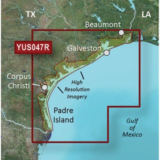
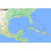
Features coverage of the Texas Gulf Coast in g2 HD detail with up to 1-foot HD fishing contours and 1-meter high resolution satellite imagery, including Corpus Christi, Padre Island, Galveston and Beaumont.
Combining on-screen navigation with the latest in high-resolution satellite imagery, this mapping product - with complete coverage on a single card - offers clear and current information regarding access to those backwaters, swamps and canals where standard government-issued marine charts may not accurately represent the shifting shorelines of navigable waterways.
- Navigate with a true and realistic "bird's eye" view of the channels and shorelines in your area by integrating 1 meter high-resolution color satellite imagery with your chartplotter's marine cartography
- Quickly and easily superimpose satellite images over your displayed charts for real-life views of waterways, landmarks, obstructions, terrain features and more
- View aerials of shorelines, roads, marinas, canals and channels, which help provide the extra situational awareness you need to clearly see the big picture
- For added perspective, BlueChart g2 HD cartography offers a choice of standard 2-D direct overhead or 3-D "over-the-bow" map views to further enhance chart interpretation and orientation
Features:
- Find marinas
- Visualize sand bars and deepest paths
- Navigate marshes in flat bottom boats
- Find points, humps and other cover that attract fish
- Up to 1-foot contours reveal detailed sea floor terrain
Coverage:
Features coverage of the Texas Gulf Coast in g2 HD detail with up to 1-foot HD fishing contours and 1-meter high resolution satellite imagery, including Corpus Christi, Padre Island, Galveston and Beaumont.


Нет отзывов о данном товаре.
Отзывы с оценкой