Магазин работает в обычном режиме. Доставка с нашего склада в США занимает около 6 недель. Оплата рублями и любой валютой. Предлагаем поставки магазинам и импортерам по оптовым ценам
Подробнее об оплате и доставке
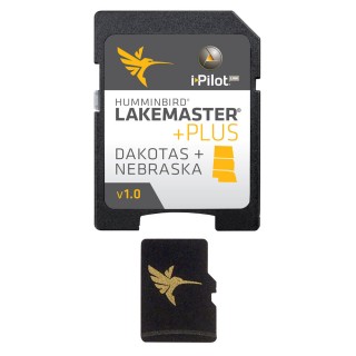
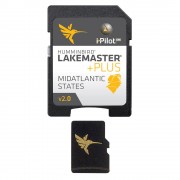
Humminbird LakeMaster Plus Dakotas/Nebraska - microSD™
Бонусные баллы: 2
15972.30 Р
Dakota/Nebraska Plus - MicroSD
HCDAKP5
Note; Opened packages will not be eligible for credit return.
The LakeMaster Advantage
The unmatched accuracy and detail of Humminbird LakeMaster give you a serious edge. Patented features include the ability to select and highlight a specific depth range, the option to shade shallow water ranging from zero to 30 feet, and the power to synchronize depth chart contours and shorelines with the current water levels of lakes, reservoirs and rivers. With these exclusive features and more, you'll have everything you need to make your time on the water more productive.
Coverage and Compatibility
Humminbird® LakeMaster® Dakotas/Nebraska PLUS, Version 1 combines many of the best fishing waters in North Dakota, South Dakota and Nebraska, all on a single map card.
The Difference is PLUS
The new PLUS series allows for aerial image overlay on high-definition waters giving you the ability to use quality aerial photography to view the entry and exits of creek channels, see how far a reef or weed line extends, and pick out shallow water rock piles, steep drop-offs or other features of the lake you've been missing from traditional maps.
PLUS also brings the groundbreaking technology of Follow the Contour to your fingertips. When combined with a compatible i-Pilot® Link™ system, your map card allows your boat to automatically follow a path directly on or offset from any contour, so you can focus on fishing.
The card includes more than 345 total lakes with contours, of which more than 100 are now in high definition. HD bodies of water include:
Additional fishing waters include:
HCDAKP5
Note; Opened packages will not be eligible for credit return.
The LakeMaster Advantage
The unmatched accuracy and detail of Humminbird LakeMaster give you a serious edge. Patented features include the ability to select and highlight a specific depth range, the option to shade shallow water ranging from zero to 30 feet, and the power to synchronize depth chart contours and shorelines with the current water levels of lakes, reservoirs and rivers. With these exclusive features and more, you'll have everything you need to make your time on the water more productive.
Coverage and Compatibility
Humminbird® LakeMaster® Dakotas/Nebraska PLUS, Version 1 combines many of the best fishing waters in North Dakota, South Dakota and Nebraska, all on a single map card.
The Difference is PLUS
The new PLUS series allows for aerial image overlay on high-definition waters giving you the ability to use quality aerial photography to view the entry and exits of creek channels, see how far a reef or weed line extends, and pick out shallow water rock piles, steep drop-offs or other features of the lake you've been missing from traditional maps.
PLUS also brings the groundbreaking technology of Follow the Contour to your fingertips. When combined with a compatible i-Pilot® Link™ system, your map card allows your boat to automatically follow a path directly on or offset from any contour, so you can focus on fishing.
The card includes more than 345 total lakes with contours, of which more than 100 are now in high definition. HD bodies of water include:
- Jamestown Reservoir, ND
- Belle Fourche Reservoir, SD
- Angostura Reservoir, SD
- Lewis and Clark Lake, SD & NE
Additional fishing waters include:
- Devils Lake, ND (1455 ft. elevation)
- Sakakawea, ND (1850 ft. elevation)
- Francis Case, SD (1355 ft. elevation)
- Oahe, SD (1620 ft. elevation)
- Sharpe, SD (1421 ft. elevation)
- Waubay, SD
Нет отзывов о данном товаре.
Отзывы с оценкой